Monday, November 4, 2013

2013 Mountain Masochist Trail Run


This  year’s Mountain Masochist was about as different from last year’s as could be possible. The obvious differentiating factor was the lack of 18” deep snow drifts this year, but what probably had more of an impact on my performance this year was a somewhat adequate training base and being mentally fresh rather than feeling like a burnt crumb of toast. Since the cancellation of Grindstone, which I’d been spending several months building towards, I’d had a gentle and slow taper, reinforced in the last couple of weeks by a nasty head cold which left me destitute of any desire for much activity beyond sleeping and eating. 

I drove down to Lynchburg Friday afternoon, stopping at a Jimmy John’s for a pre-race dinner. Hey, it worked for Robin Watkins during her double iron-distance ultra triathlon, why can’t it work for me? Somewhat salty to help water absorption, easy to digest, and pretty tasty!  I washed it down with my somewhat less tasty Osmo Pre-Load hydration drink (based on Science). 

Arriving  just in time for the very tail end of the pre-race briefing, I saw a ton of new faces and a few familiar ones. With 323 people starting the race on Saturday morning, the crowd seemed large and pretty energetic.
I passed the night comfortably in Chalet Subaru, basking in the balmy 55 degree temperatures. I felt less odd about sleeping in my car in a shopping plaza parking lot when I looked to my left and right and saw other people getting ready to do likewise. All in all, we probably had 6 or 8 people snoozing it up in our little enclave in the corner of the parking lot. Despite the glaringly bright fluorescent lights, I managed to get a pretty restful night of sleep, about 6 hours or so.

Awakening at 4AM, I promptly ate a Probar to allow maximum time to digest before the race start at 6AM. I did the usual brush teeth / finish getting dressed / put bib number on / etc. routine, electing to go with just a T-shirt, shorts, and a pair of arm warmers. Although I knew that the start of the race would be higher (and cooler) and the second half of the race would be even cooler than that, the warm temps and the strongly positive weather forecast hinted to me that I’d be OK with the lighter clothing selection. I had plenty of long-sleeve options and extra clothes in my drop bag at the halfway point anyway.
 
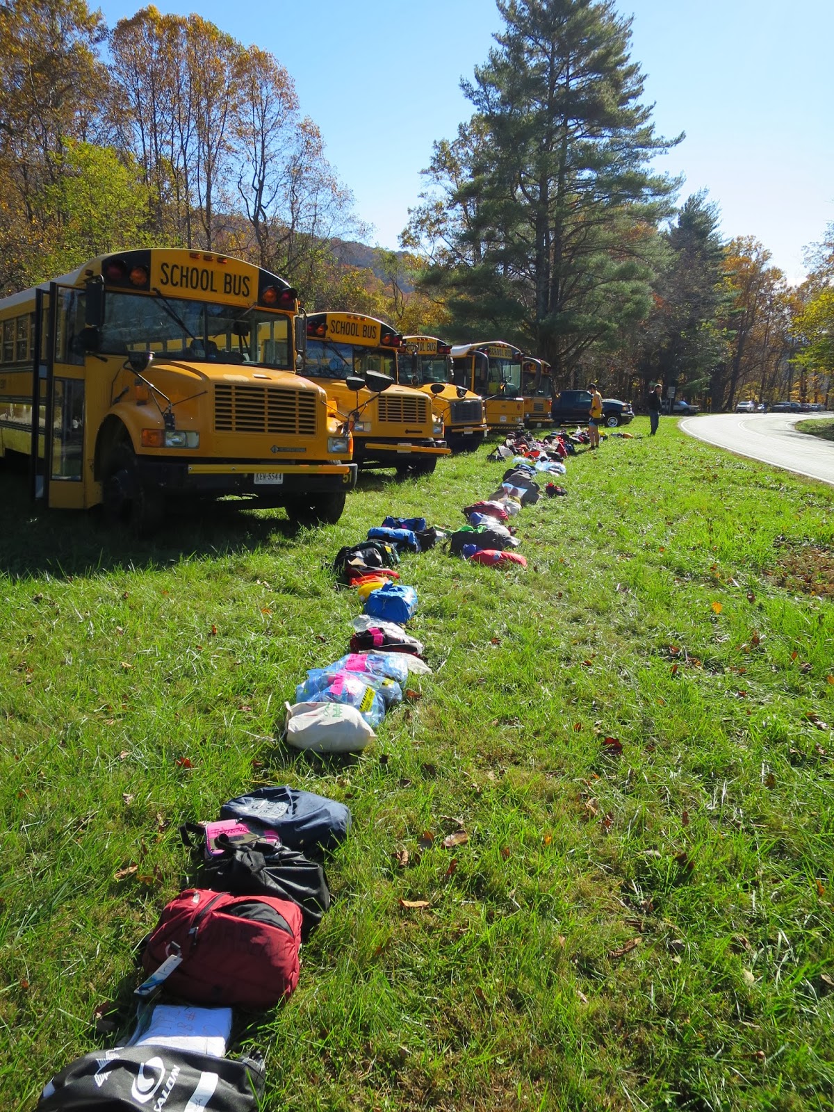
Buses lined up to transport runners to the start
I got on the bus with Danny “Ring Destroyer” Mowers, who I barely recognized due to his newly minted beard. We chatted for a bit on the ride up, then he tried to get some shut-eye and I zoned out, trying to visualize what was going to happen during the race, and simultaneously psych myself up and calm myself down.

We had made the fortuitous choice of sitting on the front row of the bus, so when we arrived at the KOA campground, I bolted out the door and scored a sweet spot in line for the port-o-lets. This was key, as the lines got pretty long later on, and getting in early gave me more time to relax on the warm bus later on before the start.

After the bathroom break I headed down to the bright lights, checked in with Clark, and then sat on the bus finishing my “30 minutes before activity” dose of Osmo Pre-Load. With 15 minutes left to go before the race start, I took 2 caffeinated energy gels, which is my go-to strategy for races where I am shooting to go hard and fast.
 
The "Light Bubble" at check-in
 
Stanley contemplates Life, the Universe, and Everything
A quick note on that – once again, I’d made the naive mistake of going into MMTR with the mindset that the “short” distance of 50 miles is something that I could just rev up and hammer through. BAD IDEA!! Not only is 50 miles not really all that short of a distance, the 9,700 feet of climbing and the endless pounding on dirt roads really takes a toll on your body. 

In the spirit of "racing hard", I'd made the decision to travel light and to depend on the abundance of aid stations for my fueling. I new that the sports drink was a Gu product, which tends to agree with my stomach, so I'd left the Osmo Active Hydration drink packets at home and filled up my water bottle with Gu Roctane, which is super-caffeinated and filled with a lot of sugar. In other words, for the first 15 miles I was both wired out of my mind and on the sugar high of my life. 

Elevation profile of the race course
We started out at a quick jogging pace, and reached the mandatory creek crossing within the first half hour or so. Kissing my warm dry feet goodbye, I looked forward to my change of shoes that I had in my drop bag at the halfway point 25 miles ahead. I ran with Gray for a little while, zooming down hills past a bunch of people. I lost Gray and got caught by Jordan and Steve going up some hills, and decided to latch onto them for a little while. 

Chasing Jordan and Steve down a hill with the sun coming up
 
The foliage was absolutely amazing when the sun came up


We flew down all the hills, and ran back up the other side. It was super fun and fast paced, and I felt like I was flying on the descents, but after about 12 miles of this I started to feel like I was working too hard to run up the hills so I moderated my pace down to a "settled in" gait, doing a slow jog / shuffle on the moderately inclined hills, walking anything steeper than that, and running at a comfortable pace on the flats and downhills.

One of the infinite sections of dirt road in the first half
 I ran with John Robinson for quite a while; we seemed to go at about the same pace. Occasionally I  would move ahead of him and occasionally he would move ahead of me, but in general we stuck together for many miles, swapping stories about flying on Aeroflot to Russia and about mountain biking. 

One of the "slow jog" sections up a super long but not too steep dirt road with John Robinson
I can never seem to remember what order the course flows in - especially in the first half. In the second half, you have the nicely demarcated sections of The Loop and the never-ending section of trail that leads you to the final aid station, but in the first half of the course things tend to blur together for me. I went up, I went down, I went past the Lynchburg Reservoir, I went past an AT trail marker. The leaves were awesome, the weather was picture-perfect, and my stomach felt pretty good from grazing on a constant stream of small foodstuffs from the prodigious amount of aid stations. I mean, with 14 aid stations, none of which are separated by more than 5 miles, there really aren't a lot of big milestone goals to reach in this race. After the first few aid stations, it just became a matter of, "OK, only 3 miles to the next".Snack, run, repeat.

Having fun somewhere near Lynchburg reservoir
Rolling Virginia hills before the halfway point - so sweet!
I got to the halfway point at Mile 27 and my drop bag in about 4 hours. I spent a few precious but absolutely-worth-it minutes changing into dry shoes and socks. After spending 3 hours slogging along in sodden Salomons, switching to my bone-dry and super-light La Sportiva Helios felt wonderful. At about 9oz for my size, it felt like having a warm feather on my foot and not much else. I grabbed some lunch (half a PB&J and two Chips Ahoy cookies) and wandered off up the long gentle climb out of the aid station.

Drop bags at the half-way point

I came across John Robinson again after the halfway point, and ran with him for the next few aid stations. For some reason, the aid station after the halfway point where they usually play dramatic cinematic music themes and have multiple uplifting signs with running-themed quotes from the Bible did not have the same impact on me this year as it has the past two years. Perhaps the music was a touch quieter, or perhaps I was more focused on just running and moving forwards. Still, it was a memorable marker in the race, and I knew that The Loop wouldn't be far away.

After an endless amount of dirt road, my legs, which had been starting to feel a little tired around mile 24, were beginning to protest. They were tired, but more importantly my joints were complaining about the beating they were getting from the road surface. Why people would want to run ultras on pavement is absolutely beyond my comprehension; even with a beautiful rural setting to take my mind off the pain, dirt roads put more impact on my ankles, hips, and knees than what I am used to. I started walking more and more, mostly on the "steeper" sections of road, still jogging the gentler uphills.

By the time I got to The Loop, a 6 ish mile segment of singletrack (one of only two short segments of singletrack on the entire course), I was ready for a break from the roads. I could move pretty easily on the downhill sections, keeping something like a 10:00min /mi pace, but the flats were miserably interminable. I actually looked forward to the uphill sections of the roads because it meant I could take a break from running and push a decently paced power walk to recover. Ryan passed me in the last few miles before the Loop, and we exchanged a few words before he moved on at a stronger pace than what I could muster.

The first portion of the Loop is a little misleading, because the trail bed is clear of leaves and debris, and it's just covered in nice smooth moss. The real fun begins when the trail takes a sharp turn to the left, starts climbing, gets covered in several inches of loose, slippery leaves, and the rocks start to litter the trail. I walked a lot, and forced myself into a slow shuffle of a jog for the flattish bits. I knew going in that this section would feel like it would take a long time, so I was mentally prepared for it when it seemed to go on forever. Before I knew it, I reached the intersection where the out-and-back section up to the peak of Mount Pleasant. This section was a bit of a snowy mess last year from the 18" snow drifts, but this year it was just a moderate slog up the hill, dodging the occasional inbound runner. I got up to the top, clambered over the boulders to get to the orienteering punch, and spared a few seconds to take in the stunning view.
The view from the top of Mt. Pleasant
The trudge down to the Loop exit took quite a bit of time, but wasn't too bad. I was moving pretty well despite having sore ankles, and despite the fact that the majority of the little foot-biting rocks were veiled by a thin layer of oak leaves. A woman passed me towards the end (I think she was the third place female) and I tried to jog when she jogged, and walk when she walked. This helped tow me in to the aid station, where I got a cup of delicious hot salty Ramen broth and a bit of cookie.

After the Loop:Out aid station, things kind of run together in my mind like an Impressionist painting - there was running, pain, drinking, eating, suffering, and constant forward motion, but no distinctive bits that stick out to give form to the whole thing. Except for the massive climb right before I got to the last trail section - that stands out like someone rubbing a cheese grater across the painting. It was big, pretty burly, and went on for a good bit longer than I would have liked; but then again, every section after the Loop went on longer than I think I would have liked.

A guy and a girl passed me right before the entrance to the final trail section, and I chased them as best I could. I knew that the section was fantastically long, and that if I had some people to mentally latch on to I would have a better chance of distracting myself from how much I wanted to stop and sit down. I was able to keep up with them until we passed a trailer sitting in the middle of the woods (odd place for that), after which I just let go and kept shuffling forward at my own pace, jogging the downhills and forcing myself to jog as much as possible on the false flats. 

After a time period roughly equivalent to the passage of the Cretaceous period, I finally emerged from the woods at the last aid station, 3.75 actual miles from the finish (not Horton miles). Jordan, being the super nice guy that he is, was standing there waiting for his wife to come through so he could finish with her. I informed him of how thoroughly he had kicked my ass earlier in the day, and set off on my last few miles of the day. 

All day, I'd been avoiding looking at my Garmin for information other than my heart rate and elevation gain. I've realized that constantly dwelling on how far I've gone and how much time has elapsed is a real mind-killer, especially if you feel that you're not meeting whatever goals you've set for yourself.  But now that I had less than four miles to run, I was free to obsess about it as much as I wanted! I realized that a sub 9:30 finish was within my grasp as long as I didn't stop too much. I wasn't worried about slowing down, because at this point I really only had one pace that I could put my motor into. I stopped once or twice for about 15 seconds to stretch my legs and to wiggle my ankles, which at this point felt like someone had been beating them with a baseball bat.

Eventually I popped out onto the nicer dirt road downhill, which turned into the paved down hill, which turned into the flat. I kept telling myself to just jog it in, which I did - nice and easy, not pushing anything. I crossed the line with a big grin on my face, sat down in a chair for a few minutes, watched some other runners come in, and then boarded the bus back to Lynchburg for the post-race dinner and the awards ceremony where I'd get my super awesome Lynchburg Ultra Series sweater jacket. Another awesome MMTR in the books!
A view of The Priest from the bus ride back to Lynchburg


.... epilogue: I did notice that when I got back to Baltimore and couldn't walk without a substantial limp that my right ankle was pretty swollen... but then the next day it felt OK. =D


Sunday, October 20, 2013

Skyline Double

I'd been wanting to do an out-and-back double century on Skyline Drive for about a year. It's such an obvious "go big or go home" objective that it was just begging to get done. This year, I finally had the opportunity (and the legs) to pull it off.

Prep began on Friday morning, with a lengthy bike-cleaning session, and an amassing of gear. My strategy was to travel pretty light, but well prepared. I grabbed any clothes I thought I might need, packed up around 4,000 calories worth of food and drink mix, and made a couple of modifications to the cockpit on my bike. A wider, more comfy Specialized Body Geometry saddle (borrowed from my mountain bike), and a set of aero bars to boost my speed on the flats and to give myself an alternate position on the bike.

Pulling an all-nighter, I wound up getting to the start a few minutes later than I'd wanted to, but was ready and rolling out at 5:15AM. The temperature in Front Royal was around 50 degrees; a bit chilly but not too bad. I knew I would warm up quickly as I climbed up onto the massive ridgeline.

The rig, ready to roll in the dark.
The first 21 miles climb almost 4,000'. This took a long time to get done, trudging upwards at about 7-8mph. Luckily, none of the grades on Skyline Drive are that steep, just long. The sun started to come up as I got past the summit of the final group of preliminary climbs,  and I raced downhill past Elk Wallow Wayside towards Thornton Gap, where Route 211 crosses over the mountains.
I taped a copy of this to my handlebars and endlessly analyzed it to determine what I had coming up on deck.
The sun starting to rise as I made my way up the hill.
One of the countless number of scenic overlooks that Skyline Drive was designed around.
The moon was full, although the overcast skies did not let it lend it's brilliance to the road. Even so, it was bright enough that I was able to turn of my little LED headlight and slowly grind up the hill in the moonlight, which was pretty cool.


Unfortunately, the overcast skies would continue all day. Although it only sprinkled rain a few times, the clouds kept the sun off and the temps down, meaning that every time I stopped I got chilled quickly. It also meant that the foliage, which was just past its peak, never got lit up enough to really capture its full intensity in a photo.

My first stop was at the Skyland resort at mile 41, where I stopped to use the restroom and to refill my water bottles. In those 40 miles, I'd done some arithmetic in my head and determined that if I wanted to get done in 16 hours (which would only have me riding in the dark for a couple hours at the end of the day), I'd have to keep a 13mph average pace. 13mph is usually much slower than I average, but your overall speed really takes a hit when you are climbing at 7mph for 20 minutes at a time. Luckily, the 30-40mph downhills really helped boost my average and I had it up to around the upper 12's in short order, and fought to maintain that for as long as possible.

After Skyland I stopped at the Big meadow campstore at Mile 51 before bridging the 30 mile gap to Loft Mountain at mile 80. I was still feeling pretty good at Big Meadow - although I was fighting sleep deprivation a little bit due to the all-nighter, I was moving well and putting out a fairly steady power of around 200 watts on the climbs and flats. The aero bars really helped me on the flats; without a buddy to draft behind, the bars made the difference between pushing 26-28mph on the flats and what would have probably been 23-25mph without them.

By the time I reached Loft Mountain, I was starting to drag a bit. The massive dose of caffeine that I'd ingested during the early stages of the ride had worn off, leaving a jittery and shaking intensity for every moment that I was off the bike. I am pretty sure I got some funny looks from tourists as I reeled around the camp store ogling the Clif bars and mumbling to myself about how good it was to fill up my water bottles with a fresh batch of drink mix.

Overcast skies made it tough to capture how pretty the foliage really was.
After I left Loft Mountain, the sun almost came out for a bit, and I enjoyed feeling it on my back. I wasn't cold, but was right on the edge of being chilly most of the time. That's a great place to be when you're working hard and your body is putting out a lot of heat, but when you're many hours into an endurance event, self-heating takes a back seat to forward movement.

Random pretty spot near the south end of Skyline Drive
I thought a lot about turning around early, but I'd already done the math and decided that I needed to turn around by 1PM in order to keep my goal of a 16 hour finish. Lo and behold, I reached the south entrance to Skyline drive around 1PM. Funny how that works. I mumbled something incoherent to the ranger at the gate about riding back to Front Royal; he looked at me and said "Have fun with that!".

The 25 miles back to Loft Mountain were pretty draining. This was the longest stretch of the ride without seeing any services, so I stopped a few times just to break up the monotony of endlessly going up and down hills. By this point I had lost interest in keeping my stops to the shortest time possible, and instead focused on mentally rejuvenating myself as much as possible each time I paused. My legs, back, and butt were all feeling pretty good, but mentally I was dragging. When your mind says "You don't have enough juice to put out 200W up this hill", guess what: you don't. However, even taking a 5-6 minute break was enough to put me back in a better headspace.

Finally I reached Loft Mountain, a fully 50 miles after I'd left. The sleep monsters were starting to leave me alone now after a caffeinated energy gel, and I was kinda sorta smelling the barn as I knew that I was on my way home. The next stop, Big Meadow, was a doable 30 mile ride ahead, and from there on out there would be services fairly often until I got back to Front Royal.

Foliage on the way back home
At Big Meadow, I took a legit break, buying a cold chicken sandwich and a cup of lukewarm coffee left over from the morning. It was warm and caffeinated though, and that's all that I cared about. Darkness was coming, and I wanted to meet it head-on with any trick I had to keep it from sapping my will to live.

I plugged my light back in, activated my taillight blinker, and started off on the last 50 miles of the trip. Despite the long-under-any-other-circumstance distance of 50 miles, I knew I was three quarters of the way done, and that was good enough to keep me motivated.

It didn't get truly dark for quite a while after I expected it to - even though civil sunset was at 6:30, I didn't have to turn my light on for probably an hour after that. The clouds finally cleared out and I was treated to some nice sunset vistas.

Sunset from the Old Rag overlook
 Once it was fully dark and I had my light on, the world took on this weird timeless sensation - I couldn't see my bike computer anymore, so I didn't know what time it was, how fast I was going, or what my power output was. It was like flying completely by feel - the only piece of feedback I had was my little elevation profile chart, which I could use to keep track of where I was (OK, climb this big hill, then a little downhill, three little peaks, followed by a big downhill). It rained on me a bit, I saw a skunk on the side of the road, and the exodus of cars from the park gradually slowed from a rush to a trickle and then finally to complete stillness.

At long last, I got to the top of the last climb before the 20 miles of mostly downhill back to the car. While I was climbing, I was pretty comfortable, but those long descents chilled me to the bone and it took a few minutes to get moving after each one. It didn't help that it must've rained in Front Royal at some point, because the road was soaking wet, making me slow down to take the corners more safely.

After counting every last mile marker post, I finally reached my car, cranked up the heat, and collapsed into the driver's seat for a lengthy nap before heading home.

Fun? Mostly. Questionable? Yes. Would I do it again? No. Was it a good idea? Seemed like it at the time. Did I think it was a good idea while I was doing it? I thought of several other things I rather would have been doing - curled up in bed sounded pretty damn good. I think if I were to try it again (or offer advice to anyone who would think about doing it), I would most certainly do it during the summer when there is a much longer day and the air temperature is a little warmer.

Sunday, July 21, 2013

SkyMass ++

The second edition of this epic road bike ride in the mountains of Virginia began with me picking John up at 4AM for the two hour drive to Front Royal. We arrived, kitted up, and were rolling before 7AM in an attempt to beat the heat. The route begins by taking you west into Fort Valley, following the valley floor for about 25 miles.
Headed through the pass into Fort Valley
Eventually we made a right turn onto Woodstock Tower Road and began climbing. After a few miles the road turns to dirt, as conveyed by this signage:

The road seemed smoother than it did last year; perhaps it was graded or improved since then, or maybe I just have poor memory. In any case, the climb was over before too long and we began the hairpin descent to Woodstock. This part of the dirt road is very serpentine. but not too steep.
John cresting Woodstock Tower Road
Hairpin corners the whole way down made things interesting
We stopped for water in Woodstock, and after a quick jaunt to the south, we began climbing Edinburg Gap. This is another good climb, about 500' in a mile and a half.
Edinburg Gap is paved the whole way
 After descending at mach 3 down into Fort Valley, it was time for another climb up past Camp Roosevelt, through Edith Gap on the way to lunch in Luray.
Me at the overlook (now hang-glider launch!) on Edith Gap

Half of a turkey sandwich and a giant pickle? Delicious! West Main Deli in Luray, VA.

Luray is a cool little town

After Luray, we had a few miles of battling headwinds on Rt. 340 to help us digest lunch before we hit Tanner's Ridge Road. Tanner's Ridge is easily the toughest, most brutal climb I've ever subjected myself to on the bike. The first mile is a 13.3% grade, climbing 700'. I think I was able to climb most of that in a straight line. After that, I started to zig-zag back and forth across the grade to lessen the pain; something I've never had to do before. And after that, the road turned into dirt and kept climbing. Good times. Oh, and I forgot to mention that it was about noon, and the temperature hit 95 with super humid air on the way up. Ouch.
Stats for the climb. Bright green is speed, dim green is cadence, pink is power, magenta is temperature, red is heart rate, orange is elevation.
Once we passed through the hell of Tanner's Ridge, we were in Skyline Drive heaven for the rest of the ride. The air temperature, which had reached scorching levels shortly after leaving Luray, moderated down by about 15 degrees, and a light breeze was more of a pleasantry than an opponent. We stopped and refueled at the Big Meadow wayside, and then rode on through the rolling hills and un-ending vistas until the final descent to Front Royal. Here are some photos.
John at Big Meadow
Rolling hills, none too steep.
Obligatory self-portrait

Obligatory group photo

No doctoring of this photo - the sky was actually that blue.


Me in front of the tunnel, practicing my "deliberately casual" pose

Caught sight of this bear cup standing by the side of the road before he shambled off into the woods.

Friday, June 28, 2013

2013 Untamed New England Adventure Race

Untamed New England... It was the best of times, it was the worst of times. Mostly the worst of times. And by worst of times, I mean the best of times. In other words, it was awesome. Confused yet? Let me step back a moment and start from the beginning.

As with any good adventure, it started with a ton of gear and some travel. I bought a new duffel bag with the interior volume of a Volkswagen Beetle, and packed it full of clothes, shoes, tools, food, and other essentials. I brushed the dust off my mountain bike from last weekend's Bailey Hundo, checked the brake pads, replaced the bottom bracket, slapped a pair of Nobby Nics on the hoops and packed it back up.
My portion of the gear stash

I met up with Adam, Robin, Vlad, and Dima at BWI airport - we all were on the same flight out. During the flight, we looked over some maps of the area, and reviewed the communications from the organization. Upon landing in Portland, Vlad and I dashed off to rent a mammoth SUV while the others stayed behind to pick up the bikes and gear. This is where the first piece of bad news hit us - My bike didn't make it on the plane!

We were already in scramble mode, trying to get to the race registration before they stopped giving out maps. If we missed the map pickup, we would be at a huge disadvantage because we would have to pick them up in the morning, giving us next to no time to plot a course. Not having my bike there threw a wrench in the works of our adventure machine. After a tense conversation with the empathetic and helpful baggage agent, we decided to head to the race check-in, hoping that my bike would make it on a later flight. During the 2-1/2 hour drive to Sugarloaf, where the check-in was, I got a call from the baggage agent that they had found my bike and would put it on the next plane from Baltimore. Whew!

Unfortunately, this meant that I would have to drive back and retrieve my bike. We got to the race check-in, received the maps, and headed to the hotel. After checking in at the hotel, I promptly turned around and hustled back to Portland, leaving the planning to my very capable teammates.

I got to the Portland airport around midnight, picked up my bike, and was back at the hotel by 3:30AM, having stopped a few times for catnaps and snacks. I shuffled a few items around in my pack, doing my best not to wake the others. I finally got to bed around 4AM, just in time to be awakened at 5:45AM to get ready for the race.

Instead of patiently being able to put my bike together the previous night, I was scrambling to put it together in the 90 minutes before starting off into the great unknown. If this wasn't enough pressure, when I went to re-attach my derailleur, the hanger bolt exploded; I must have over-torqued it a little while trying to make sure it was secure. We ransacked our gear looking for a replacement bolt, and had settled on zip-tying the derailleur hanger in place (which actually worked, at least pedaling around the parking lot) before Dima appeared out of nowhere with a hardware angel who had a whole bin of random nuts and bolts. Amazingly enough, this person just happened to have the derailleur hanger bolt that I needed! Overjoyed, I attached my derailleur to my bike and dropped my duffel full of gear and food at the bag drop.
Team Calleva, ready to go. Photo by Vladimir Bukalo

During the 90-minute bus ride to the start of the paddling section, I tried and failed to grab a few winks of sleep. With only about 2 hours of sleep from Friday night, and a guaranteed all-nighter in front of me, I needed every bit I could get. Unfortunately, race nerves and the bouncing bus prevented me from doing anything but closing my eyes for a bit until we got to the start.
The start!

The race started with a short run through the woods to get to our boats. Adam and I hopped in one canoe, Robin and Dima hopped in the other, and we were off in a mad canoeing dash along with 30-odd other teams. After a few minutes of both trying to steer the canoe, Adam and I sorted out that it was best if I just stoked (being in front) and while he steered. We paddled at a decent pace, but kept falling behind bit by bit as the hours wore on. I know for me personally paddling is not my strong suit compared to running and cycling, so I'll have to work on that! I took my hands off the paddle for just a few moments to snap some pictures.
Dima and Robin paddling
Adam and I in the boat.

The paddling section was pretty uneventful. The rapids were more mellow than what we encountered at the Rev3 race, and we managed to avoid bumping into most of the submerged rocks. I was even able to keep my feet dry when getting out of the boat! However, just because it started off easy didn't mean it would stay that way. We packed our paddling gear into our packs and set off up a trail. It wasn't long until Dima proposed we bushwhack uphill to get to a smoother trail that didn't have as many people on it. We did, and got onto a road. We almost went right past the trail that we'd marked on the map last night, as it wasn't very well marked. Luckily Robin caught the blaze, and we followed the trail up through some dense humidity to reach CP2.

After that, we followed some more trails and dirt roads, skirting around the edges of some ponds. We crossed a portage trail, which the map showed going straight through the pond - it really was for portaging! At one point we got on the Appalachian trail for a couple of miles, which gave me newfound respect for anyone who could have been running on that part of the course. It was very wet and slippery, with tons of roots and rocks. We proceeded at a fast walk, jogging where we could.
Untamed New England = Untamed Foot Bridges
After a while, we came to a swampy area at the edge of a lake, and proceeded to bush whack through it to get to the next checkpoint. For a while we were able to keep our feet dry, but eventually the muck-to-dry-ground ratio became such that stomping through the mud was just faster.

The "path" through the swamp at the edge of the lake
The checkpoint's location meant we'd have to get our feet wet anyway
After grabbing the checkpoint, we proceeded to bushwhack along the edge of the lake, aiming to reach a road that continued around the eastern side of the lake. After twisting, turning, hopping and thrashing through some moderately dense thicket, we decided to just hop in the lake and wade along the shore. It was less than waist-deep, and although we didn't move very fast at least we were moving in a straight line.
Pushing through the swamp felt like traveling the Forest Moon of Endor
Wading on the edge of the pond


We ended up popping out through some guy's back yard, garnering some odd looks although we tried to be exceedingly polite. We got on the road and continued around the pond to our next objective, a bushwhack up to the top of a minor peak. Looking back at it on Google Earth, there was a road almost all the way to the top. This road wasn't on our map, but we found it and followed it about halfway up before we found some logging trails that we were able to follow up to a saddle adjacent to the summit. After threading our way through some thicket we got to the top, admired the views for a moment, and then bushwhacked down to another road to continue on our way to the transition area.

Bushwhacking - not so bad.
Bushwhackers converging on the summit from all directions!
The view from the summit - quite nice. Flagstaff Lake with what I believe is Bigelow Mountain in the background.
Back into the thicket
Running down the road towards the transition area
We got to the transition area and packed up, knowing that we'd be going for about 12 more hours without seeing our gear again. The paddles and PFDs went into our teams paddling gear bag, and a clean dry pair of running shoes and socks went into my backpack for later use. We fueled up, eating some previously frozen (now thawed) burritos.

As we left the transition area, a few mechanical problems reared their head immediately. My derailleur was doing some weird stuff where it was dragging on the chain when coasting or pedaling backwards, which caused some slack to appear in the chainline. This didn't really pose a practical problem unless I needed to ratchet through some tough technical sections, so after a brief look we decided to ignore it. Robin's drivetrain was also having problems, not shifting into the small chainring in the front. After attempting to fix this by adjusting several things we gave up; post-race examination under calmer conditions revealed that the chainring was in fact bent, causing it to skip in and out of granny gear.

I didn't take many pictures during the biking section, mostly because my camera batteries were on the brink of going dead (it had decided that it was a good idea to turn itself on and play a slideshow for a few hours in my drybag, apparently). Our route to the next checkpoint at Stratton Brook Hut was mostly on dirt roads, with a few sections of pretty good single track trails.

We had a bit of trouble navigating to the hut - while the route appeared pretty simple on paper, in real life it was difficult to tell which intersection you were at. This is because there were many trails that appeared on the map that did not appear in real life, and for a long time we were traversing along a slope, so we didn't have any good terrain features to confirm our position. We turned uphill a bit too early and reached a dead end at logging area; a stick got stuck in Robins derailleur, bending it so that she was now stuck with just 4 usable gears. Nevertheless, we pushed onwards and reached Stratton Brook Hut after a steep hike-a-bike climb.

At Stratton Brook Hut we transitioned back over to trekking gear for the orienteering course. We had been stressing about getting to the hut quickly, because we would need to complete the orienteering course and be back at the hut by midnight, and we were behind schedule. Luckily the O-course turned out to be amazingly simple, just an out-and-back on some trails, and we completed it in about an hour and 40 minutes and were back at the hut by 10:30.

We put on plenty of warm clothes for the next bike section, as it was a long descent back into the valley. The descent was fairly uneventful, and we arrived at the base of the next climb without any trouble other than checking our maps repeatedly to make sure that we were on the right track.

The climb went on forever. It wasn't too steep, so we were able to ride several section of it, but at 2AM any long climb will seem interminable. Reaching the top was a cause for celebration! We paused to snack and to put on a layer for the descent down to the next checkpoint, which was where we would leave our bikes to embark on the final trek of the race, up and over Sugarloaf Mountain.

About halfway down the descent, it started to rain. After a few big fat drops hit, it started to pour. We were cruising at a pretty good clip downhill, so within minutes we were completely soaked, despite wearing all our raingear. Stopping briefly at intersections to verify our location, we eventually made it down to the U-Haul at the transition area at 3:05AM.
A sight for sore eyes!
Dima and Robin pulling up to the transition area. Can you tell that it's wet??

Unfortunately, the race organizers had made the call at 2AM to instate a new cut-off at this transition area at 3AM. Not knowing about this cutoff (we'd been out in the middle of nowhere when the decision was made), we'd arrived 5 minutes too late and were told that we were not allow to continue on the course. This was very demoralizing; I'm sure that if we'd known there was a cutoff at 3AM we could have pushed a little harder, stopped a little less, whatever it took to get us there 5 minutes faster. Oh well, such is life.

The alt course lead us back to the main road in the valley. It was seven miles on a side road, and then 14 miles on the main road back to the start/finish area. Those first seven miles were downhill, and in the soaking rain they were pretty cold and miserable. At the intersection with the main road, we stopped under the awning of a hardware store to put on any dry clothes that we had left and to eat some snacks.
Taking a break under shelter at 4:00AM
The 14 miles up the main road were really bad - after all the adrenaline and mental energy we'd been putting into navigating and paying attention to our surroundings, 14 miles on the same paved road was a total snoozecase. In fact, I'm pretty sure I literally fell asleep on my bike for a slip second a couple times. We did all sorts of things to try and keep ourselves awake - talking, standing up on the bike, short sprints, riding with no hands. Eventually we made our way back to the finish, tired, dirty and wet, but happy to have finished.
A little haggard but glad to be done. Photo by Vladimir Bukalo
Not exactly a huge crowd to greet us. Although the keg of beer was nice!
We took hot showers (awesome) with cold beers from the keg (double awesome), napped in the car for a little bit, and then packed up and headed home.